I love my dear Ural Mountains! And therefore created a whole section dedicated to this region of Russia. It provides materials as my personal, from various hiking in the Urals mountains and just encyclopedic materials about each individual region of the Ural Mountains. This section is a guide to the Ural Mountains and will be very useful to tourists, travelers and simply lovers of nature. Attractions of the Urals, numerous photos, description of the region.
Polar Ural - the most northern part Ural Mountains. Mount Konstantinov Stone is considered to be the northern border of the region, and in the south the border with the Supilla Urals is the Lyapin River (Hulger). The area is about 25,000 km.
Porpolar Urals - Mining system in Russia. Its northern border begins on the origins of the Lyapin River (Hulger) 65 40 's. sh., And in the south, the border passes through the mountain of Telposis 64 p. sh. Geographical objects Polar Urals.
Northern Urals - part of the Ural Mountains. It begins from the Kozvinsky stone and the Korzhakov Stone neighboring with him (59 ° S.Sh.) in the south to the northern slopes of the massif Telposis
The average Ural is the lowest area of \u200b\u200bthe Ural Mountains, lies between 56 ° and 59 ° C. sh. The South border is considered to be Mount Jurma, which lies in the Chelyabinsk region, and North - Mountains Kosvinsky Stone and his neighbor - Korzhakovsky stone.
The widest part of the Ural Mountains. Located in two states: Russia and Kazakhstan. The southern outskirts of the Southern Urals (Mulgarians) run on the territory of the Aktobe region of the Republic of Kazakhstan.
The largest rivers Urals. In the Urals there is a large number of rivers suitable for alloys - shipping rivers. The most popular routes in the Ural rivers. Photo, description of the most interesting rivers.
Manci - the people constituting the indigenous population Northern Urals This Finno-Ugric people are direct descendants of Hungarians (belong to the Ugric group: Hungarians, Mansi, Khanty).
Walking through the Urals forests, we bump into a wide variety of different plants, bright colors rushed to our eyes. But not having a special botanical education, we often do not know what kind of plants
A hike on the tract of Dyatlov Pass in June 2016. My spontaneous ride to the pass, then as it was. How to get to Dyatlov's pass on the car and walking? Detailed report.
The river ride was held on August 12-13, 2014. We came to the ridge from the east side, through Severouralsk and the main Ural Range, which lies on the border between the Perm Territory and the Sverdlovsk region.
This campaign on the mountain Shunut-stone was issued in October 2010. We walked fourwise. The weather was very good, sunny. However, the yard was already October - and it was pretty cool. Already were freezing.
In June 2011 went to main Mountain and main Ridge Sverdlovsk region - Konzhakovsky stone. Korzhak is a favorite place to climb many tourists from both Yekaterinburg and from all over Russia.
The campaign on the ridge Taganay was quite good. We visited the rolling ridge and on the mountain Kruglitsa. We looked at South Ural Taiga, in which there are many Linden, probably instead of the Siberian cedar.
We reached the bus to the city of Kachkanar. It was even early morning, more precisely, even night. Waited until dawn at the bus station. How to get to the mountain Kachkanar, we had no idea - and therefore began to ask for employees of the bus station.
Mount High Jairel is located on the border of Bashkiria and the Chelyabinsk region. The case was approximately at the end of July - early August 2011. There were 10 people, 2 passenger cars.
At the end of August 2011, we managed to escape to the north of our region - to the main Ural Range (Gush). It is located strictly on the border of the Sverdlovsk region with the Perm Territory and stretched from the south to the north.
The Ural Mountains are among the oldest mountains in the world. They have a relatively small height, the highest point - Popular Mountain - just 1895 m above sea level. A small height of such a huge mountain system is caused by the age of the mountains. During its existence, the high mountains were destroyed, forming heaps of stone placers - Kurumov. But once a long time, the Ural Mountains did not give anything to some Sayanam or even, maybe the Himalayas himself!
The surroundings of the ridges are covered with taiga forests, at the heights of over 800 m begins the belt beltundra, at the heights of above 850-900 - tundra. On the Southern Urals Mountains are covered with a steppe and have small sizes. On the Far North - Tundra. Tundra portions of the mountain Science of centuries were a great place to walk deer, local indigenous people of this region. The belt of the mountain tundra suitable for the walking deer comes to the central part of the Northern Urals - the plateau Quarks. Below the Quarkly, the mountain tundra is relatively rare.
The climate in the mountains is continental, moderate continental. Winter at altitudes over 850-900 meters comes early, the snow falls in September and continues to lie all year in the form of small snowfons even in the midst of summer - in July. Open hills are very windy, which gives climate more harsh conditions. In the summer, the sun can warm up to + 30-33 degrees, and in winter there are temperatures to -57 (Village Burmanto, Ivdelsky district).
Ural Mountains - unique for our country natural object. Probably not to think about answering the question why. Ural Mountains - the only mountain chainwhich crosses Russia from north to south, is the boundary between two parts of the world and the two largest parts (macroregions) of our country - European and Asian.
Geographical position of the Ural Mountains
The Ural Mountains stretched from north to south, mainly along the 60th Meridian. In the north they are bent towards the northeast, to the Peninsula Yamal, in the south - turn to the southwest. One of their features is that mountain territory Expands as moving from north to south (it is clearly visible on the map on the right). In the south, in the area of \u200b\u200bthe Orenburg region, the Ural Mountains are connected with the number of elevations, such as the common crawling.
As it seemed strange, the exact geological border of the Ural Mountains (consequently, the exact geographical border between Europe and Asia) still cannot determine exactly.
The Ural Mountains are conditionally divided into five areas: Polar Urals, Parliamentary Urals, Northern Urals, Middle Urals and South Urals.
To one degree or another, part of the Ural Mountains capture the following regions (from north to south): Arkhangelsk region, Komi Republic, Yamalo-Nenetsky autonomous District, Khanty-Mansiysk Autonomous Okrug, Perm Territory, Sverdlovsk region, Chelyabinsk region, Republic of Bashkortostan, Orenburg region, as well as part of Kazakhstan.
The origin of the Ural Gor.
The Ural Mountains have a long and difficult story. It begins in the Proterozoic Era - so an ancient and unstasted stage of the history of our planet, that scientists do not even share it for periods and epochs. Approximately 3.5 billion years ago at the place of future mountains there was a gap of the earth's crust, which soon reached the depth of more than ten kilometers. For almost two billion years, this break expanded, so about 430 million years ago an ocean formed, a width of up to a thousand kilometers. However, soon after that the rapprochement of lithospheric plates began; The ocean relatively quickly disappeared, and mountains were formed in its place. It happened about 300 million years ago - this corresponds to the era of the so-called Hercino folding.

New major raising in the Urals resumed only 30 million years ago, during which the polar, and the same, northern and southern parts of the mountains were raised almost per kilometer, and the middle of the Urals - about 300-400 meters.
Currently, the Ural Mountains stabilized - large movements of the earth's crust here are not observed. Nevertheless, they still remind people about their active history: from time to time earthquakes happen here, and very large (the strongest one had an amplitude of 7 points and was not registered as long as long ago - in 1914).
Features of the structure and relief of the Urals
From a geological point of view, the Ural Mountains are very difficult to arrange. They are formed by rocks of various types and ages. In many ways, the peculiarities of the internal structure of the Urals are associated with its history, for example, traces of deep faults and even the sections of the oceanic crust are still preserved.
The Ural Mountains are medium and low in height, the highest point is the People's Mountain on the Supolar Urals, reaching 1895 meters. It is curious that the second highest top of the Urals - mount Yamantau - Located in the Southern Urals. In general, in the profile of the Ural Mountains remind of depression: the highest ridges are located in the north and south, and the middle part does not exceed 400-500 meters, so that crossing the average Urals can not even notice the mountains.

View of the main Ural ridge in the territory Perm region. Photo by Yulia Vandyysheva
It can be said that the Ural Mountains "are not lucky" in terms of height: they were formed in one period with the Altai, but they later experienced much less raising. The result is the highest point of Altai, Mount Belukha, reaches four and a half kilometers, and the Ural mountains are more than twice as lower. However, such a "sublime" position of Altai turned into a danger of earthquakes - the Urals in this respect is much safer to life.

Typical vegetation of the belt of mountain tundras in the Ural Mountains. The snapshot is made on the humboldt mountain slope (the main Ural Range, Northern Urals) at an altitude of 1310 meters. Photos by Natalia Shmaenkova
The long, continuous struggle of volcanic forces against wind and water forces (in geography the first is called endogenous, and the second - exogenous) created a huge number of unique natural attractions in the Urals: rocks, caves and many others.
The Ural is also known for the huge reserves of minerals of all types. This is primarily iron, copper, nickel, manganese and many other types of ores, building materials. Kachkanar Iron deposit is one of the largest in the country. Although the metal content in ore is small, it contains rare, but very valuable metals - manganese, vanadium.
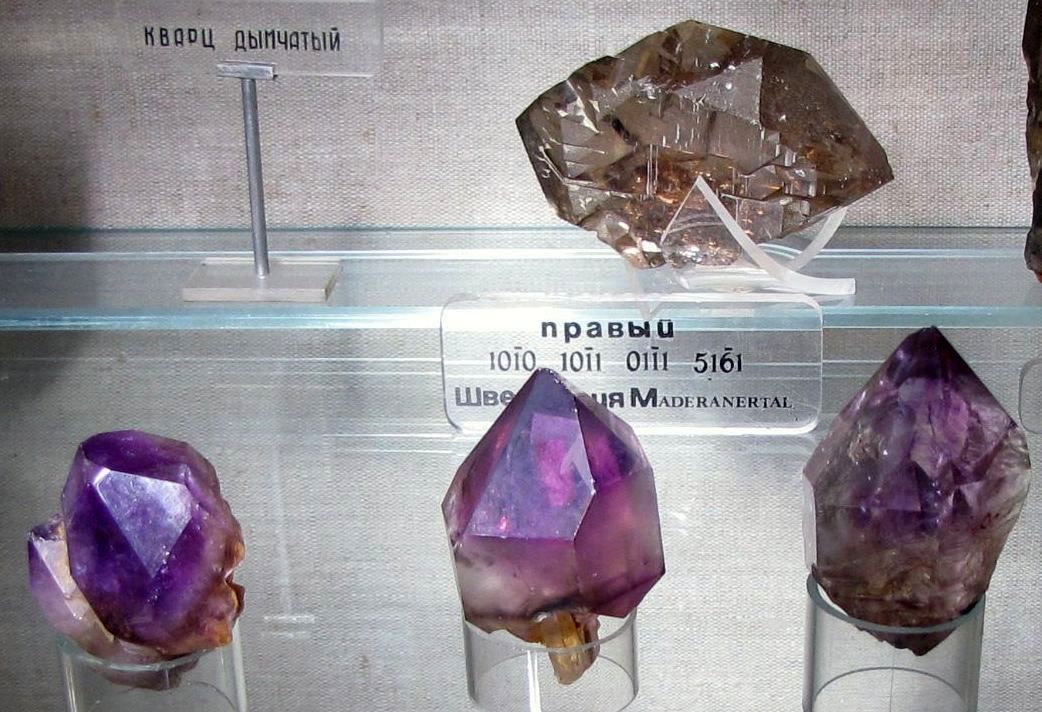
In the north, in the Pechora coal pool, mined coal. There are in our region and noble metals - gold, silver, platinum. Undoubtedly, the Urals precious and semi-precious stones are widely known: emeralds mined near Yekaterinburg, diamonds, gems of the Murzin strip, and, of course, the Ural Malachite.
Unfortunately, many valuable old deposits have already been developed. "Magnetic Mountains" containing large stocks of iron ore turned into careers, and the reserves of malachite have survived except in museums in the form of individual inclusions on the site of old developments - even three hundred cellogram monolith is hardly possible. Nevertheless, these minerals largely ensured the economic power and fame of the Urals for the century.
Text © Pavel Symin, 2011
website
Film of the Ural Mountains:
The Ural Mountains are a mountain system between the Eastern European and West Siberian plains. Length more than 2000 (with Pai-Hoam and Muurgas - more than 2600) km, width from 40 to 150 km. Geological structure The Ural Mountains were formed in Late Paleozoa in the era of intensive mountain formation (Hercinsk folding). The formation of the Mountain System of the Urals began in the Late Devon (about 350 million years ago) and ended in Triassa (about 200 million years ago). Is an part of Ural-Mongol folded geosynclinal belt. Within the Urals on the surface, the deformed and often metamorphic rocks of predominantly Paleozoic age are published. The thickness of sedimentary and volcanic rocks is usually strongly broken, broken by breaking, but in general form meridional bands resulting in linearity and zonality of the structures of the Urals. From the West to the East allocated:

Pre-Ural regional deflection with a relatively gentle occurrence of sedimentary stump in Western board and more complex in Eastern; the zone of the western slope of the Urals with the development of the sedimentary thickness of the lower and middle Paleozoic intensively crushed and disturbed; The Central Ural Raising, where among the sedimentary thickness of the Paleozoic and the Upper Precamibria, more ancient crystal rocks of the region of the East European Platform are published; The system of deflection-synclinory of the Eastern slope (the largest - Magnitogorsk and Tagil), made mainly by the middle-powerly volcanic strata and marine, often deep-water precipitation, as well as those who break through their deeply erupted rocks (gabbroids, granitoids, less often with alkaline intrusions) - T. n. greenland belt of the Urals; Ural Tobolsky anticlinorium with exits of more ancient metamorphic rocks and a wide development of granitoids; East-Ural sinkinium, in many respects similar to Tagil-Magnitogorsk.

At the base of the first three zones according to geophysical data, the ancient, early-membrane, the foundation, complicated mainly by metamorphic and magmatic rocks and formed as a result of several ears of folding, is confidently traced. The most ancient, allegedly Archean, breeds go to the surface in the Tratask ledge on the western slope of the Southern Urals. Moody breeds in the foundation of the Sincline of the Eastern Slope of the Urals are unknown. It is assumed that the foundation of Paleozoic volcanogenic thickness of syncliniodies serve powerful plates of hyperbsitts and gabbroids, places of leaving on the surface in the arrays of the platinum belt and other belts related to it; These plates may be refrigerated by the ancient ocean lodge of the Ural geosynclinal. In the East, in the Ural-Tobolsky anti-clinosition, the yields of the Precambrian rocks are pretty problematic. Paleozoic sediments of the western slope of the Urals are represented by limestone, dolomites, sandstones formed in the conditions of predominantly shallow seas. Eastern intermittent stripes are more deep-water precipitation of the continental slope. Even east, within the eastern slope of the Urals, the incision of Paleozoic (Ordovik, Silur) begins by the changed vulcanite of basalt composition and jaspers, comparable to the breeds of the bottom of the modern oceans. The places above the cut, there are powerful, also changed spilite-sod-liparite strata with deposits of medical-accepted ores. More young sediments of Devon and the Silur partly are presented mainly by Andesito-basalt, Andesito-Dacito volcanites and gravels that meet the development of the eastern slope of the stage of the stage, when the oceanic earth is replaced by the transient bark.
Coal deposits (limestone, grain-vaks, acidic and alkaline volcanics) are associated with the latest, continental stage of the development of the eastern slope of the Urals. At the same time, the main mass of Paleozoic, substantially potassium, urals granites, formed pegmatite veins with rare valuable minerals, was introduced. In the Late-Caughty Perm Time, the sedimentation on the eastern slope of the Urals almost ceased and a folded mountain structure was formed here; On the Western slope at this time, the pre-rally regional deflection was formed, filled with a powerful (up to 4-5 km) of the thickness of the wreckage driving from the Urals, Molasses. Triassic sediments have been preserved in a number of pridin-rabbens, the emergence of which in the north and east of the Urals preceded basalt (trapping) magmatism. The younger strata of the Mesozoic and Cenozoic sediments of the hollow platform nature overlap folded structures along the periphery of the Urals. It is assumed that the Paleozoic structure of the Urals laid in the late Cambrian - Ordovic as a result of the splitting of the lateokembrybry continent and the sneakers of its debris, as a result of which the geosynclinal flow was formed with the crust and precipitation of the oceanic type in its inner part. Subsequently, the expansion changed with compression and oceanic wpadin began to gradually close and "overgrow" the newly emerging continental bark; Accordingly, the character of magmatism and sedimentation was changed. The modern structure of the Urals wears traces of the strongest compression, accompanied by a strong transverse reduction of geosyncline depressions and the formation of geagagine scales.

In the history of our country, the scientific community is more than once and did not try to explain how the Ural Mountains were formed. The hypothesis of the formation of the Urals arose, challenged and went into oblivion, and now, to list all the hypothesis of the formation of the Urals is impossible, they are too much.
By its origin, the mountains are obliged to connect to the holistic continent of Europe, Siberia and Kazakhstan, before existing in the form of isolated continents and even the islands. The Ural rose on the site of the collision of these large slices of sushi, denoting the border between them.
- From the Russian platform, the Ural separates the pre-Ural deflection consisting of sedimentary rocks (clay, sand, gypsum, limestone).
- The Ural Mountains were formed in the period of Paleozoic, but they were almost completely destroyed in the mesozoic.
- Separate parts of the Urals rose during the times of Neogen, experienced rejuvenation but also these folding-boulder Ural mountains were destroyed as a result of the impact of external forces (weathered and erosion).
After all, there was an incredible kaleidoscope from the facts a thousand times certified and rechecked observations. Researchers had to logically link the obvious reality of finding literally a number of heterogeneous sediments. And currently crushed siliceous tile chips of the formations of the ocean bottom, which moved three hundred and four hundred million years ago. And the wound ridges listed in the depth of the ancient mainland glacial arrays of hundreds of thousands of years ago. And the exposure of the rocks of the granite or gabbral series, destroyed by the winds and the sun, but which could only be formed on the multi-kilometer depths of the earth, in the gloomy relief of the awards of the thrill temperatures and thousands of atmospheric pressure. And sandy spit sediments who were missing here are not one million tons of sand and alert of the collapsing mountains ...
So to this day, all this allows equal to exist at the same time, dozens of a wide variety of assumptions about how the land lived in the Uralsky limits in the entire billionnlennu history. To this day, deciphering its true history is the current and most complex problem of geologists.
True, today scientists have determined at least with the criterion on which they share the hypothesis of the formation of the Ural mountainous country.
This criterion is cosmogonic. He finally made it possible to group all points of view by their attitude towards the original substance of the planet Earth.
Ural Mountain Education Hypotheses
Supporters of the same approach converge in the opinion that all the celestial bodies visible from the Earth - and the planets, including - formed as a result of rapprochement, the seals scattered to that cosmic surprit. It was either the same as meteorites falling on our planet, or was a flashlight of the fire-liquid melt. The creators of the hypotheses created on this message include the philosopher Kant, and the famous mathematician and astronomer Laplace, and the outstanding Soviet researcher Otto Yulievich Schmidt. By the way, B. soviet schools We studied mainly hypothesis from this series. And they are not so easy to challenge them - meteorites continue to fit into the ground and to this day, increasing its mass. And what is still a terrestrial core - liquid, no doubt, probably no geologist. Yes, and the law of global leaving accommodation properly determines the movement of the shone and planets.
Supporters of another approach claim that all the planets (the land, of course, it is not exceptions for them) the essence of the debris from the advice, formed due to its explosive expansion, that is, in their opinion, the process of dispellation of the substance of the universe. The great Lomonosov did not deny this look, now many leading geologists and cosmologists of the world and our country are adhered to ...
And their conviction is clear. Astronomers set: going to the ground, the light from all visible stars shifts into the red part of the spectrum. And there is only one of this satisfactory explanation - all the stars will fly away from a certain center. This is a consequence of the dispellation of the substance of the cosmos.
According to the latest estimates, our planet exists as a separate celestial body about four and a half billion years. So: in the Urals found breeds whose age is defined as not less than three-billion. And the whole "tragedy" for supporters of the hypotheses is that this established fact is easily explained from the standpoint of both points of view ...
If you believe the encyclopedia, it is a mountain system between the Eastern European and West Siberian plains. Its length is more than two thousand kilometers, and according to some data more than two and a half thousand (if you calculate the Pai-Hoi ridges together in the north and Mulgarians - in the south). The width of the system ranges from 40 to 200 kilometers.
Some of the most ancient mountains on our planet (the oldest Mountain of New Zealand). That is why they are not as high as the same Tibet or Andes. The age of the Ural Mountains has more than 600 million years and for this for a long time the mountains managed to thoroughly collapse under the influence of winds, rains and landslides. Already steel common place Applications that the Ural Mountains are very rich in fossils. Indeed, in the Urals you can meet the deposits of copper, magnesium, titanium, coal, oil, bauxite, etc. In total, specialists have more than fifty-five most important minerals and ores.
History of opening of the Ural Mountains
The history of the opening of the Ural Mountains begins with antiquity. More precisely, it will be that this is the opening history for our civilization, and in general, people settled the Urals in significantly earlier times. The first written mentions about the Ural Mountains we meet the Greeks. They talked about the mountains of Imaus, Ripeye (Rhypsy) mountains and the hyperborean mountains. It is now very difficult to establish what part of the Ural Mountains said scientists ancient Greece and Rome, because Their narratives are very abundantly equipped with legends, fairy tales and frank non-residents. It is clear that they themselves have never been in the Urals and heard about the Urals of third or even the fourth and fifth lies. Somewhat later, already from Arabic sources could have learned more detailed information About the Ural Mountains. Arabs spoke about the country of the Ugra, where the people of Yura lived. In addition, it is certainly to the Urals include descriptions of countries such as Visa, the country of Yagoodja and Maggudge, Bulgaria, etc. All Arab sources converge in one: the territory of the Ural Mountains was populated by the fierce people and therefore was closed for travelers. Also, all of them in one voice talk about harsh climatic conditionsWhat actually suggests that they mean precisely the Urals. But, despite these facts, their attention still was riveted to the Ural Mountains, because It was here that the source of the two most important currencies of the Middle Ages - Ferns and Salts, which quoted no less than gold and precious stones. Starting from 13-14 centuries (according to some data, even from the 12th century) Urals and Ural Mountains They began to master Russian pioneers. First, the Ural Mountains were known under the name of the stone. So they said "go for the stone", i.e. To the Urals and to Siberia. Already starting from the 17th century, in many respects thanks to Vasily Tatishchev, the territory of the Ural Mountains received the name of the Urals. The Ural, in fact, is translated as a mountain or a stone belt from Mansiysk (sometimes they talk about Turkic, namely the Bashkir origin of this word).
Water resources of the Ural Mountains
In the Urals, just a huge number of lakes, rivers and streams. Mountain lakes You can count in the amount of 3327 (!). The overall length of the rivers is more than 90,000 (!) Kilometers. Such rich water resources They are associated with a large area of \u200b\u200bthe catchment, which, in turn, is due to the peculiarities of the landscape. Most rivers are of mountain nature, and therefore, very rapid, relatively shallow and transparent. The rivers are found by Siberian and European Harius, Taimen, Pike, Sudak, Nalim, Okun and others. Fish. Thanks to all this, it is simply ideal for water tourism and sports fishing on smoking, Tieta and Siga.

The main vertices of the Ural Mountains.
The highest peak in the Urals is a mountain People's Mount (1894.5 meters). By the way, it is necessary to say with the emphasis on the first syllable, because The name has happened from the word "downshift" and is associated with mansiysk legends, which say exactly from here we went, i.e. Made, comi-perm. In addition to people, there are some more "branded" and significant vertices in the Urals. In the South Urals, this is the mountains of Yamantau (1640 m), Greater Jerlel (1582 m), a large shell (1427 m), Nurguash (1406 m), Kruglitsa (1168 m) and a combing ridge (1155 m).

Comb is responding. Photo Maxim Tatarinova
On the Middle Urals it is necessary to celebrate the mountains of Oslka (1119 m), Kachkanar (878 m), old stone (755 m), shunut-stone (726 m) and white mountain (712 m). In the Northern Urals, the highest peaks of Korzhakovsky stone (1569 m), a stone of stone (1492 m), the mountains of purust (1292 m), the mountains are separated (1182 m; famous for the fact that he is near Dyatlov's pass), skin-from (1195 m ) and Telposise (1617 m). Speaking about the mountains of the Northern Urals can not be circumvented by the famous Mago Pupa-Ner - these are the stones of the remains near the Mountain Koyep.

Manpupener. Photo Sergey Ischenko
The most significant vertices of the Popular Urals: Already mentioned by us People's Mountain, Mount Manaraga (1820 m), Mount Kololnya (1724 m), Mountain Protection (1808 m), Mount Mansy Nierr or Didkovsky Mountain (1778 m) and others. How to notice It is the mountains of the Supolar Urals are the highest.
Well, and in the Polar Urals it is necessary to allocate the mountains of the Payer (1499 m) and NGETENAPE (1338 m).

Manaraga
Such a large number of mountains of different heights, caves (which naturally eating in the mountains), rivers and lakes became the main reason for development active tourism in the Urals. In the Arsenal of Urals (and not only Ural) tourists and hiking routes, and mountain trekking, and alloys on rivers, and combined tours, and ethnographic tours, as well as sports fishing and hunting.
Ecology of the Ural Gor.
The issue of ecology in the Urals is very acute. Initially served a certain pantry for the state. The industry has always been developed and anthropogenic pressing on nature has always been felt. Today, out of the most acute problems can be called cutting down forests, the consequences of the extraction of underground fossils, dams on rivers (hydropower plants), the work of harmful chemical, cellulose and metallurgical industries. In order for readers to make an impression of the Urals as a certain industrial colony, we note that work on improving ecology in the Urals is conducted. Already on the territory of a very large number of reserves, parks and reserves. The largest of them: the Vishero Reserve, Yighd Va National Park, the Methast Stone Reserve, etc. In addition, private fishing farms, recreation areas and recreational areas with ecological routes and trails are increasingly appearing with the development of tourist business in the Urals. All this in aggregate allows you to hope that the ecology of the Urals will not be violated and will allow many more and many tourists to relax and even improve their health in the Ural Mountains.


Much better go to Cyprus with children
Waterfall Victoria Short description
Offer for Guides Booking Excursions on Online Service
Club of famous captains Full list Club of famous captains
Tale Resistant Tin Soldier